
Last fall, northern California was shrouded in smoke. The Camp Fire, as it came to be called, raged in Butte County for two weeks. Hazardous air quality forced schools—some up to 100 miles away—to close for several days. It was the sixth deadliest wildfire in U.S. history, leaving 18,000 structures destroyed, 5 firefighters injured, and at least 85 people dead.
As firefighters got the blaze under control, they turned to their newest tool: drones. A team of firefighters, police, rescue personnel, and private companies used the remotely operated aerial vehicles to take over 70,000 images of the scorched areas. Then they combined all this data to map the damage.
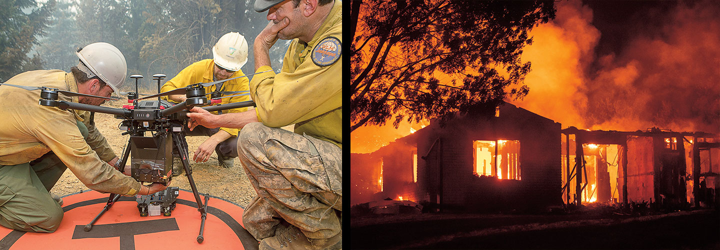
Last fall, northern California was blanketed by smoke. The Camp Fire, as it came to be called, burned in Butte County for two weeks. Smoke in the air made it dangerous to breathe outside. Schools up to 100 miles away had to close for several days. More than 18,000 buildings were destroyed, 5 firefighters were injured, and at least 85 people died. It was the sixth deadliest wildfire in U.S. history.
As firefighters worked to control the blaze, they used a new tool to help. They flew drones, or remotely operated flying vehicles, over the fire. A team of firefighters, police, rescue workers, and private companies used the drones to take more than 70,000 photos of the burned areas. Then they combined all this data to map the damage.